Despite the climate we see on Mars today, scientists now agree it was warmer and wetter 3.5 to 4.1 billion years ago, during the Noachian and Hesperian eras. Evidence of this first emerged with the first robotic probes to explore Mars, but became undeniable with the arrival of landers and surface rovers, i.e., Viking 1 and 2, Curiosity, and Perseverance. This has raised the question of whether Mars could have hosted life during this period, most likely in the form of microbial organisms.
Hoping to shed light on this, a research team led by scientists from the Institute of Science Tokyo created a global map showing where ancient rains may have delivered an important prebiotic molecule, formaldehyde (H₂CO), across the planet billions of years ago. This map could help guide future astrobiology efforts on Mars by directing robotic and crewed missions to sites where evidence of past life could still be preserved.
The research was led by Dr. Shungo Koyama, an astrobiologist at the Institute of Science Tokyo and Research Fellow at Tohoku University. He and his colleagues (from both institutions) were joined by researchers from the Research Center for Advanced Science and Technology at the University of Tokyo, the Department of Earth and Space Sciences at the University of Washington, and the Royal Belgian Institute for Space Aeronomy (BIRA-IASB).
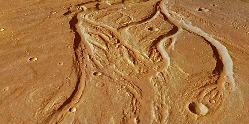
Ancient riverbeds can still be seen on the surface of Mars and it is here that the focus will lie in the search for life (Credit : ESA/DLR/FU Berlin)
The research, which appeared in The Planetary Science Journal, builds on previous work that showed how H₂CO could form in the atmosphere. When combined with water, formaldehyde can serve as a precursor molecule for chemical reactions that produce sugars, amino acids, and other complex organic molecules that give rise to life. The one remaining question was, where on Mars would formaldehyde have reached the surface?
To create a map of the possible locations, the researchers simulated what conditions were like in the late Noachian and early Hesperian period. They then examined how temperatures, water vapor, atmospheric pressure, and UV light affected the formation of formaldehyde. Their simulation showed that the chemical dissociation of water by UV light in Mars’ atmosphere would release the reactive hydrogen essential to form H₂CO, which would fall to the surface in rain.
Because water influenced both the formation and distribution of H₂CO, the researchers hypothesized that Mars’ ancient water cycle may have determined where it would accumulate. The last step in the map’s production was to plot these potential hotspots were in relation to landing sites for past Mars missions. Some areas stood out from than others, including mountainous regions like Tharsis and Elysium, which recieved about ten times the global average. Said Dr. Koyama:
By comparing our map with findings from rovers, we can begin to test whether places that received more H₂CO were also more favorable for early life-related chemistry. If future observations confirm this relationship, our map could help identify promising targets for future Mars missions.
While this study does not show how much formaldehyde remains on the Martian surface today, the map could help in the selection of landing sites for future missions. In the meantime, it also provides hints as to how organic chemistry evolved on Mars billions of years ago, which could also help future missions refine their strategies for finding evidence of it today.
Further Reading: Tohoku University, The Planetary Science Journal
About the Author

Source: Universe Today