This post was originally published on this site.
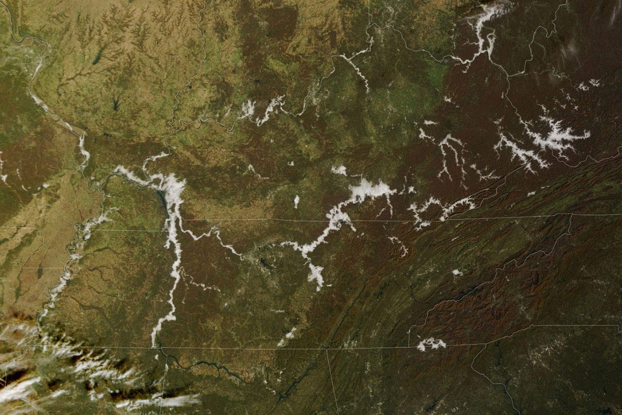
On a cool November morning, low clouds traced the branching valleys of the Appalachian Plateau and the Cumberland River. By afternoon, they had faded, leaving clear skies over the autumn landscape.
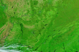
The change is visible in this pair of images from November 8, 2026. The MODIS (Moderate Resolution Imaging Spectroradiometer) on NASA’s Terra satellite acquired the left image that morning. In this natural-color view, low clouds appear white as they fill many of the valleys. Autumn vegetation appears in shades of brown and green.
The VIIRS (Visible Infrared Imaging Radiometer Suite) on NOAA-21 acquired the right image that afternoon, after the clouds had dissipated and exposed the rivers and lakes beneath them. This false-color view makes it easier to distinguish water (dark blue) from vegetation (bright green).
The clouds appear to be fog, a type of cloud that forms near the ground. Foggy mornings in the region are common this time of year. As nights lengthen, the ground has more time to radiate away the day’s heat, and the air just above it cools to the dew point—the temperature at which air becomes saturated and water vapor begins condensing into the tiny droplets that make up fog.
Because cold air is denser than warm air, it flows downslope and pools in valleys, so fog tends to form there first. Notice the fog filling the branching valleys across part of the Appalachian Plateau in eastern Kentucky and southwestern West Virginia. Rivers and streams that run along many of the valley floors add to the effect by supplying extra moisture. The same pattern is visible along the Cumberland River and its reservoirs in north-central Tennessee and south-central Kentucky.
According to the National Weather Service, temperatures in many places on the morning of November 8 dipped into the 30s Fahrenheit before giving way to a mild, sunny afternoon. Forecasters reported locally dense valley fog that morning. Dense fog had also blanketed a wider part of the region earlier in the week, prompting advisories for hazardous travel conditions.
NASA Earth Observatory images by Lauren Dauphin, using MODIS data from NASA EOSDIS LANCE and GIBS/Worldview, and VIIRS data from NASA EOSDIS LANCE, GIBS/Worldview and the Joint Polar Satellite System (JPSS). Story by Kathryn Hansen.
November 8, 2026, Terra MODIS
November 8, 2026, NOAA-20 VIIRS
About the Author