
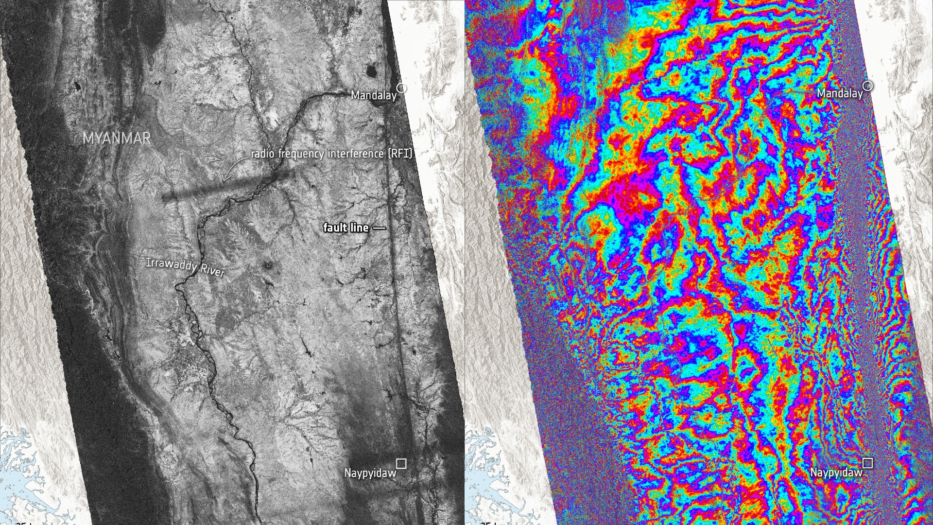
Europe’s Sentinel-1 satellites captured radar images of Myanmar before and after a magnitude 7.7 earthquake struck on March 28, revealing significant ground movement.
About the Author

Europe’s Sentinel-1 satellites captured radar images of Myanmar before and after a magnitude 7.7 earthquake struck on March 28, revealing significant ground movement.